Princes Town (Princes Town)
Princes Town is a town within the Princes Town Regional Corporation, located on southern Trinidad island in Trinidad and Tobago. The population of the town is 28,335.
Founded as the Amerindian Mission of Savana Grande, the town was renamed after the 1880 visit by Queen Victoria's grandsons, Prince Albert and Prince George (later King George V). The Princes each planted a Poui tree (Tabebuia sp.) at the Anglican church in the area, which still survives to this day.
The sugar industry that had helped to build the economy of Princes Town was closed in 2003, leaving hundreds of workers on the breadline. With the closure of the industry, there was a decline in activities in the town as well as the surrounding estates.
In the area of culture, the early East Indian families brought to Cedar Hill Village, a village on the outskirts of the town centre, the festival of Ramleela. Cedar Hill is generally regarded as the first village where the cultural practice began. The amphitheatre in which the festival is held ranks among the best in Trinidad for open-air theatrical performances. The lands on which the amphitheatre is located were donated to the Ramleela organisation of Cedar Hill by Usine Ste Madeleine. Every year, thousands of patrons descend on this site to take part in the celebrations.
Princes Town still remains the centre of stickfighting, which is part of the Carnival celebrations. Every year on January 20, an observance called Princes Town Day is held in the town under the auspices of the Princes Town Regional Corporation.
Map - Princes Town (Princes Town)
Map
Country - Trinidad_and_Tobago
 |
 |
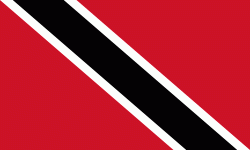
| Flag of Trinidad and Tobago | |
The island of Trinidad was inhabited for centuries by Indigenous peoples before becoming a colony in the Spanish Empire, following the arrival of Christopher Columbus, in 1498. Spanish governor José María Chacón surrendered the island to a British fleet under the command of Sir Ralph Abercromby in 1797. Trinidad and Tobago were ceded to Britain in 1802 under the Treaty of Amiens as separate states and unified in 1889. Trinidad and Tobago obtained independence in 1962, becoming a republic in 1976.
Currency / Language
| ISO | Currency | Symbol | Significant figures |
|---|---|---|---|
| TTD | Trinidad and Tobago dollar | $ | 2 |
| ISO | Language |
|---|---|
| ZH | Chinese language |
| EN | English language |
| FR | French language |
| ES | Spanish language |


